Screenshots
Scroll to see all screens →
Emergency Intelligence Platform
The only app that combines severe weather, scanner audio, and a 14-tool field kit. One-time purchase. No subscription. Ever.
Download on the App Store → Scroll to see all screens →
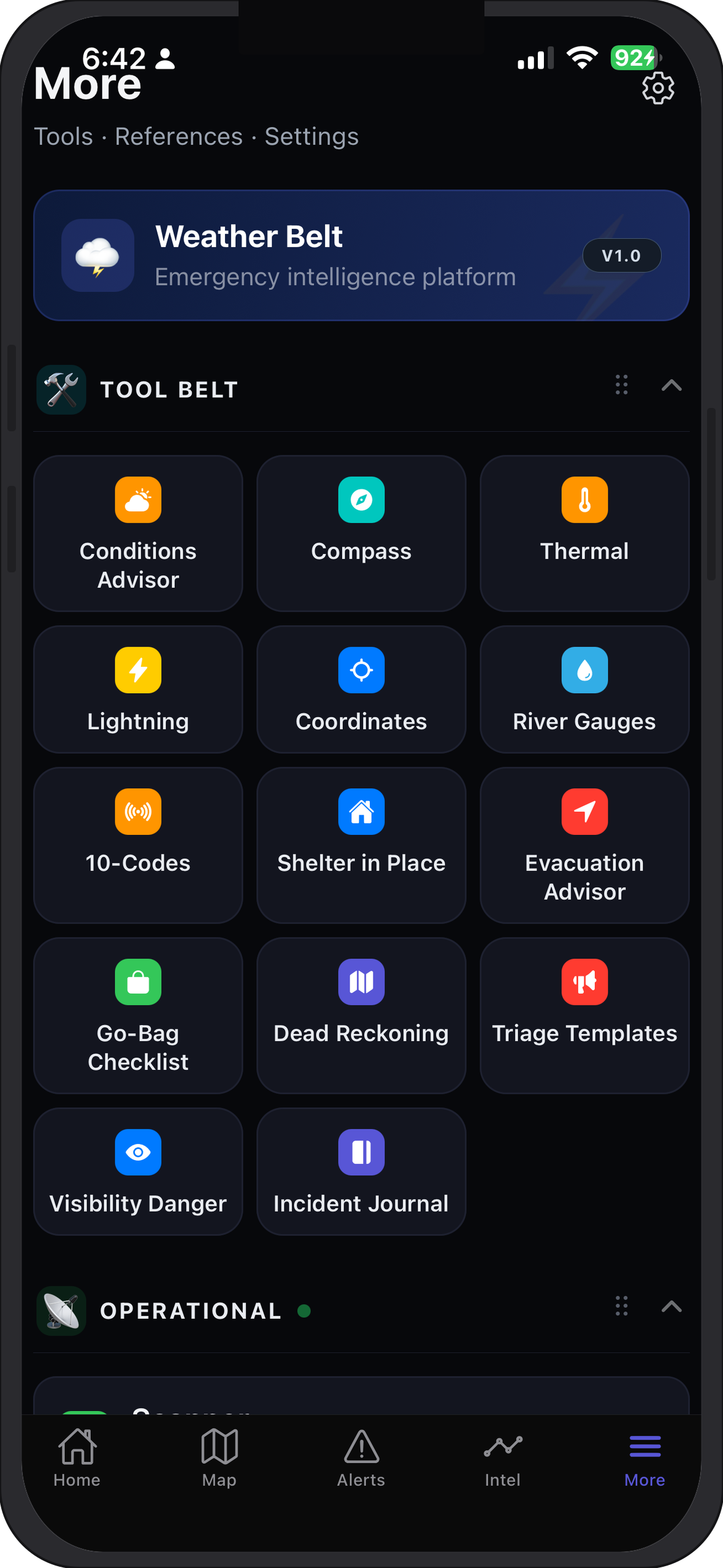
Fourteen field tools built into Weather Belt—navigation, thermal math, comms templates, and incident logging alongside your map and feeds.
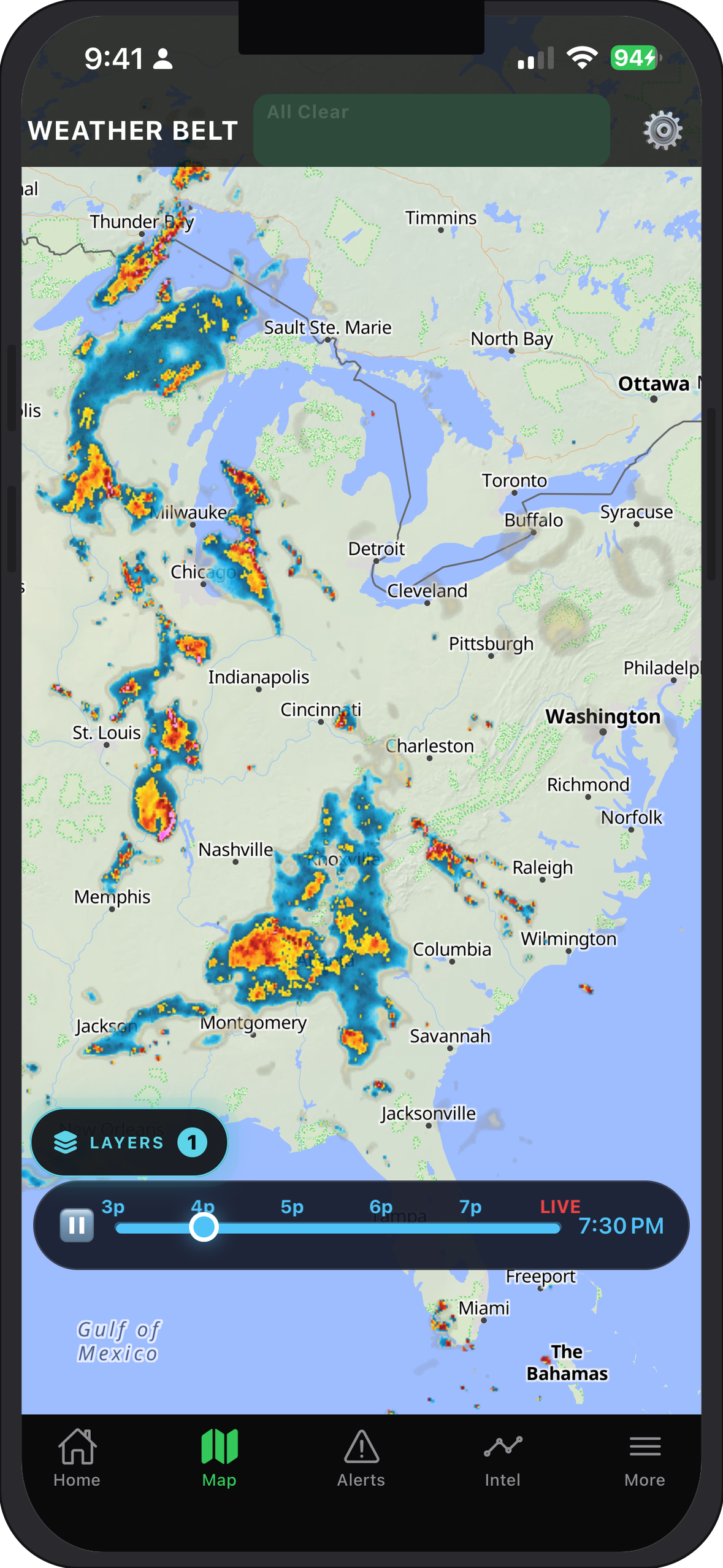
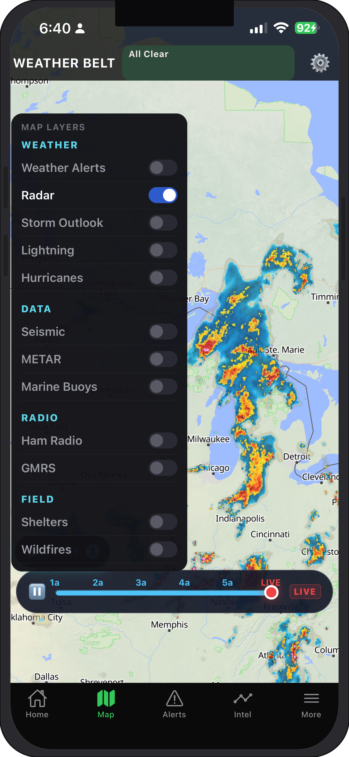
Unified layers for WX, seismic, aviation, marine, wildfire, NEXRAD, power outage, and radio feeds with fast drawer access.
Bring your own key for OpenAI, Anthropic, or Google. Keys stay encrypted locally on your device.
Built-in emergency and decoding references available without internet for field reliability.
Live county-level outage data via DOE ODIN — free, no key required. See affected counties, customers out, and estimated restoration time. Upgrade to street-level data with a free PowerOutage.com key.
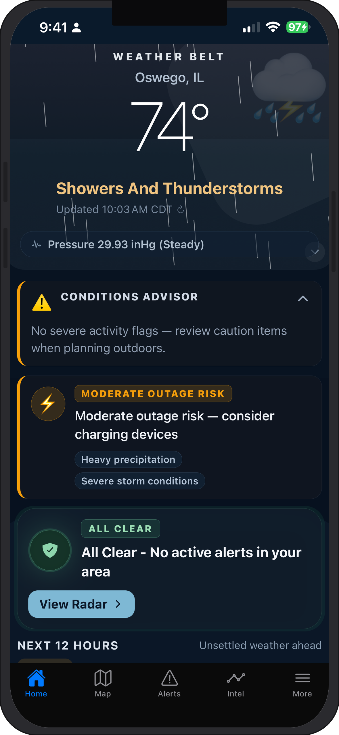
Weather Belt is an all-in-one emergency weather and event monitoring system for storm chasers, ham radio operators, and anyone who wants all the tools in one app.
When conditions change fast, you should not be jumping between browsers, radios, and half a dozen specialty apps. Weather Belt pulls authoritative feeds, map layers, AI interpretation, and reference material into a single map-first workspace built for field use—whether you are tracking a supercell, monitoring seismic activity, or coordinating on GMRS during an outage.
Ghost Logics built Weather Belt for people who treat situational awareness as a discipline: live layers you can read at a glance, agents that translate raw data into plain language, and hardware-conscious behavior so you are not burning battery on redundant polling. On iOS, with a one-time purchase—no subscription wall between you and the tools you rely on when it matters.
From NEXRAD to scanner audio, one command surface keeps telemetry and references aligned so you interpret what the atmosphere, ground, and airwaves are telling you—not fight your tooling.
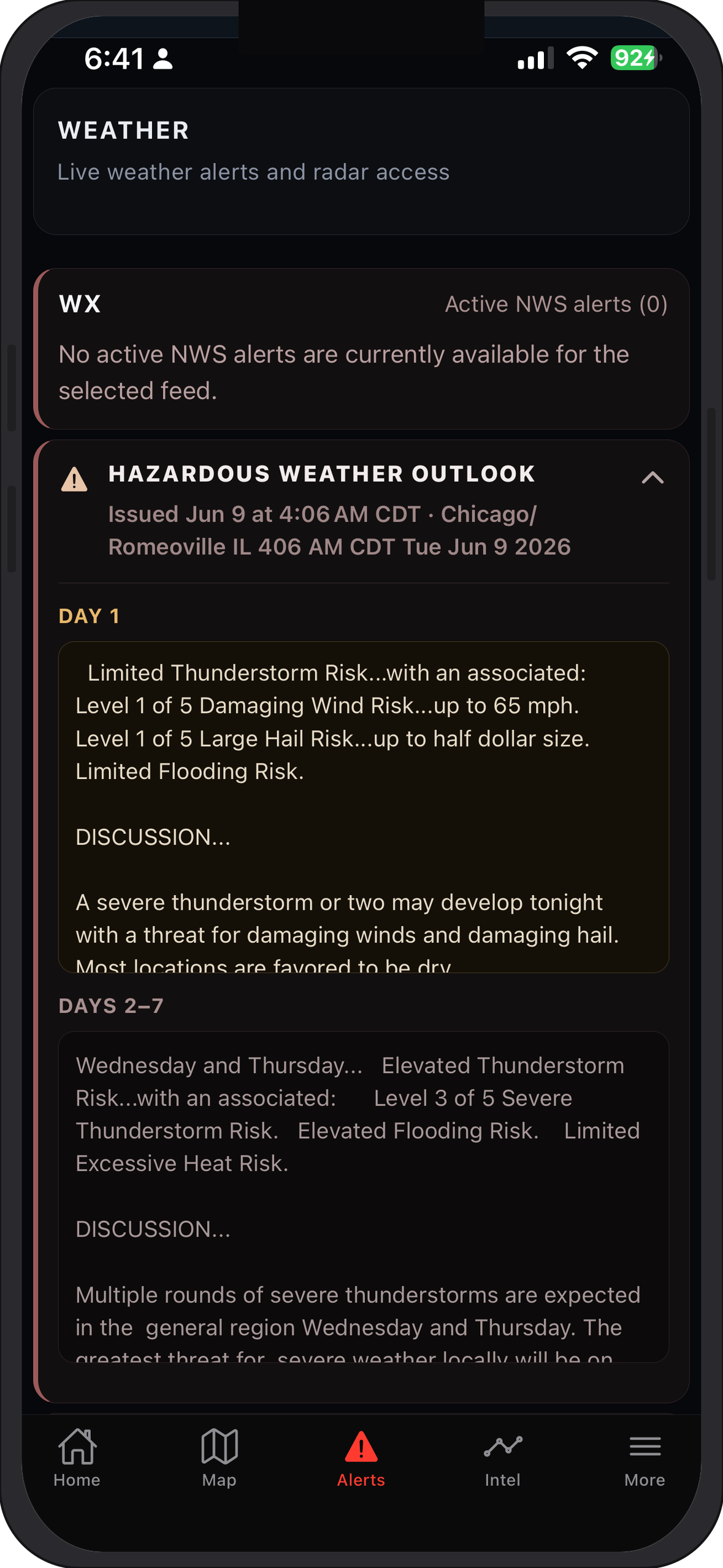
Weather Belt connects to vetted institutional and open data sources—not scraped or opaque feeds. The stack includes NOAA/NWS for watches, warnings, and meteorological context; USGS Earthquake Hazards Program for seismic reporting; FAA/NOAA METAR for aviation weather; NDBC (National Data Buoy Center) for marine observations; NASA FIRMS (Fire Information for Resource Management) for wildfire hotspots; DOE ODIN for county-level power outage data; and repeater directory data via Radio Reference so operators validate frequencies in-app.
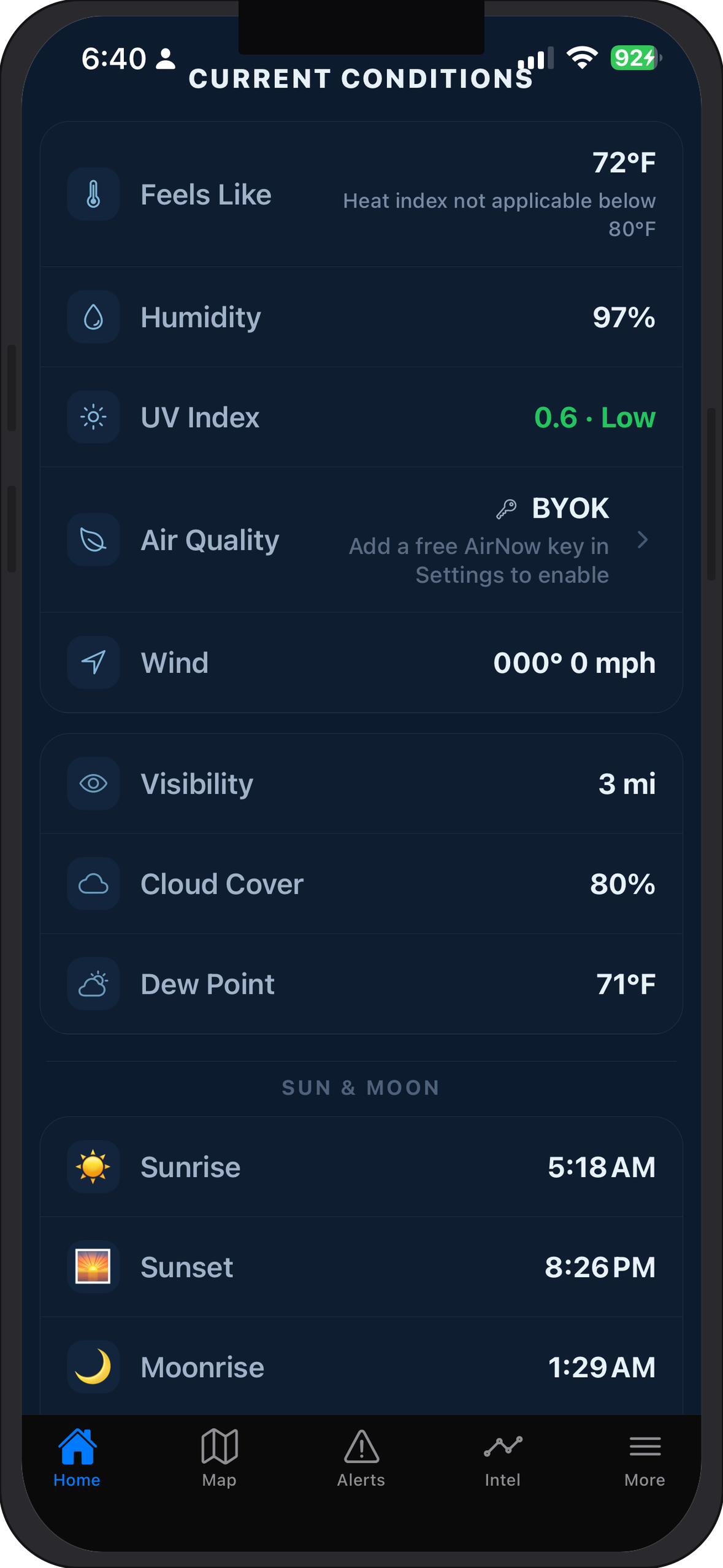
Live monitoring layers turn those feeds into map context: NEXRAD radar, seismic traces, marine buoys, METAR aviation reports, wildfire hotspots, power outage map, temperature and conditions, lightning (LTG), air quality (AQI), tide data, and sunrise/sunset with moon phase when overnight chases or comms windows matter.
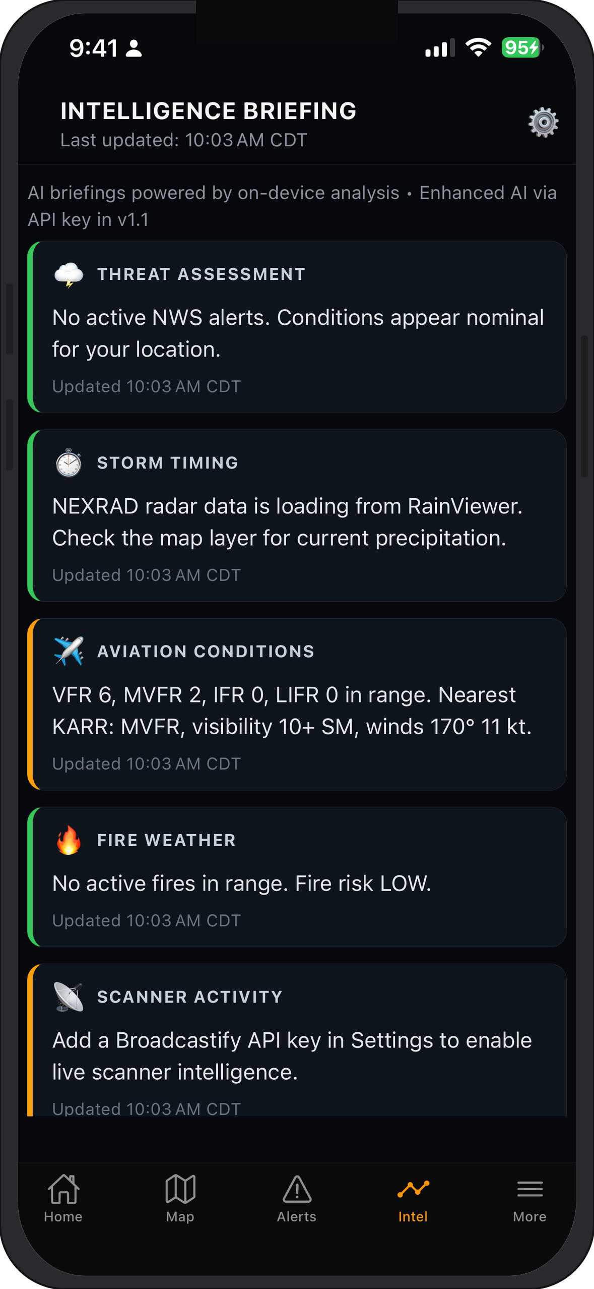
Six specialized agents—Weather Interpreter, Scanner Decoder, Incident Analyst, Evacuation Advisor, Marine Briefer, and Aviation Briefer—are each prompted to monitor, understand, and translate emergency events into plain language you can act on immediately. Bring your own keys for OpenAI, Anthropic, or Google; keys stay encrypted on device, and each agent stays scoped so answers tie to the live stack on screen—not generic chat.
Weather Interpreter correlates radar and METAR into chase-ready summaries. Scanner Decoder untangles overlapping public-safety audio. Incident Analyst merges multi-hazard feeds when earthquakes, weather, and fire collide. Evacuation Advisor stresses routes and timing. Marine Briefer condenses buoy and tide intel; Aviation Briefer compresses METAR and hazard products for pilots and spotters who need fast text.
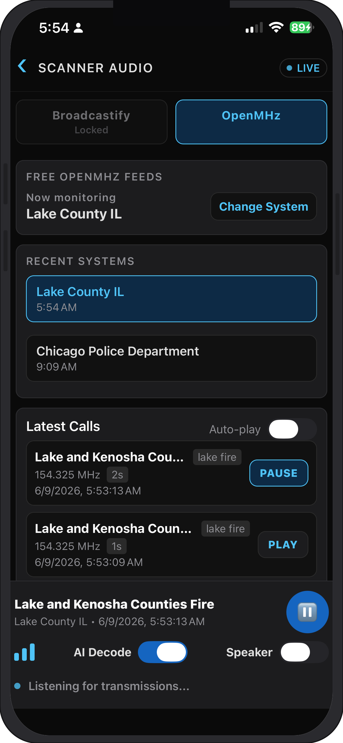
Scanner audio integration means real-time scanner audio is built directly into the app, aligned with map context. Ham and GMRS repeater lookup adds an integrated repeater directory for operators who need verified pairs in the field.
Geofence zones define geographic alert areas so emphasis follows the regions you choose. Offline reference screens keep key data without internet—critical when towers are congested or you are off-grid. The in-app reference library holds emergency and weather reference material for pre-study and offline consultation.
Ingest, visualize, interpret, and communicate in one iOS hub—without juggling separate tools.
Storm chasers, preppers, boaters, ham and GMRS radio operators, first responders, hikers, and anyone interested in weather monitoring and emergency situational awareness.
Storm chasers get radar, lightning, and AI briefing together. Preppers and hikers lean on offline references and geofenced alerts. Boaters use NDBC, tides, and marine agents without a pile of marine apps. Ham and GMRS operators pair repeater lookup with scanner audio. First responders and advanced users get institutional-grade feeds and a map-first layout without enterprise pricing or mandatory cloud accounts.
Roadmap features in active development—community layers, trusted spotter workflows, richer sharing, and in-vehicle access.
$9.99, one-time purchase on the Apple App Store. No subscription, no renewal fees.
Several features and reference screens are accessible without an internet connection, making Weather Belt reliable in the field when connectivity is limited.
Each of the six AI agents is purpose-built for a specific emergency context. They monitor live data, interpret conditions, and translate complex events into clear, actionable language — so you spend less time decoding and more time responding.
Weather Belt is currently iOS only.
More answers in our Support & FAQ section.
$9.99 — One-time purchase. No subscription. Available on the Apple App Store.